
Scan-to-BIM: surveying and modeling
Build an accurate, usable BIM model based on laser scanning of your building or existing survey data, providing a reliable foundation for design, construction and facility management.
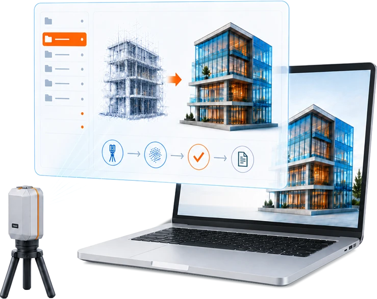
Every successful project starts with reliable survey data
What does the service include?For existing buildings, inaccurate source data is one of the greatest project risks.
Missing or outdated drawings often lead to continuous design revisions, on-site coordination and repeated measurements during both the design and construction phases.
With our Scan-to-BIM service, we eliminate this uncertainty.
We capture the building’s actual current condition using laser scanning and convert it into a structured BIM model. The model is not only geometrically accurate but also suitable for subsequent design, construction and facility management processes.
The result is a reliable digital foundation for the entire lifecycle of the building, allowing every project stakeholder to work from the same accurate information.
Scan-to-BIM is for you if...
Who is it for?You don't have as-built documentation
There is no reliable documentation of the existing building before renovation, extension or refurbishment.

You don’t have a BIM model, only 2D drawings
Your project is based on 2D documentation but you want to convert it into a BIM workflow.

You want BIM-based construction
You want to use BIM clash detection or construction support before construction begins.

You want BIM-based facility management
You want to improve building operations with accurate and reliable data.

How can we help
ServicesLaser scanning and point cloud generation
01We capture the existing building using high-accuracy 3D laser scanning and generate a detailed point cloud.
The data is cleaned, registered and organized into a unified dataset, providing a reliable basis for BIM modeling.
BIM models for design
02Based on the point cloud or existing drawings, we create BIM models specifically optimized for the design process.
The models include the required level of detail and appropriate simplifications to support concept design and permitting. Editable Archicad or Revit files can also be delivered upon request.
BIM models for construction
03We develop BIM models tailored to construction requirements, with greater detail and more accurate geometry.
The models are suitable for coordination, clash detection and on-site construction workflows.
Construction progress monitoring
04We regularly compare the BIM model with the as-built condition using point clouds or 360° surveys. This clearly identifies where construction differs from the design, allowing deviations to be detected early.
Early identification enables faster corrective action, reduces rework and improves project control.
BIM models for facility management
05The model contains not only geometry but also the information required for building operations.
We deliver structured asset and space data, ensuring the model remains valuable for long-term facility management.
BIM model validation
06We perform various model validation services, including clash detection, rule-based checking and quality assurance.
The results are delivered in a clear and transparent format, making it easy to identify where corrective action is required.
Virtual walkthroughs
07We create interactive virtual tours from 360° surveys, providing a realistic representation of the building’s current condition.
The tours can be shared online, allowing project stakeholders to inspect and review the building remotely without visiting the site. This is particularly useful for surveys, coordination meetings and project documentation.
Process
How does the process work?
From laser scanning to the completed BIM model, we follow a well-defined workflow. Through high-precision surveying and professional modelling, we ensure that the final result provides a reliable basis for design.
Get in touch- 01
Defining the required level of detail
In the beginning, we discuss in detail how the model will be used (e.g. renovation, coordination, construction or facility management). Based on this, we define the required level of accuracy, level of detail and information content. We also establish the modeling boundaries, required deliverables and software environment.
- 02
On-site laser scanning
We perform a high-accuracy 3D laser survey on site, capturing the building's actual condition without distortion. If a point cloud already exists, we import and process it by removing noise, registering the scans and creating a unified dataset ready for modeling.
- 03
Creating the BIM model
Base on the point cloud, we build the BIM model with the required level of detail. The model is not only geometrically accurate but also logically structured for efficient use throughout design, coordination and construction. We ensure that it complies with the project's BIM requirements. We support Revit, Archicad, Civil 3D, Allplan and Tekla file formats.
- 04
Reviewing and finalizing the model
We perform a multi-stage quality assurance process, checking geometric accuracy, model consistency and information content. Any outstanding questions are clarified before we deliver the model in a well-structured and documented format, ready for immediate use in the next project phase.
References
Featured Scan-to-BIM Projects
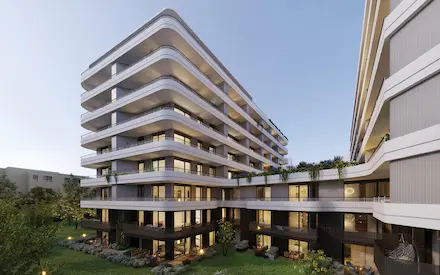
Dévai Street Residential Building
We supported the project participants with BIM management services.
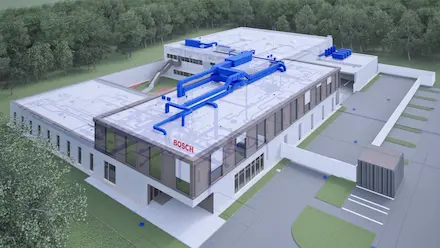
Bosch R&D Centre
We supported the project with BIM modelling and management.
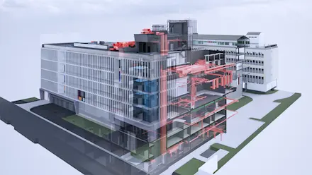
NMHH Office Building
We created a multidisciplinary BIM model for facility management.
Our goal is to advance digitalization across Hungary's construction industry, making it more efficient and more competitive internationally.
 Ádám Kovácsmanaging director
Easier project management, more reliable project delivery
A precise Scan-to-BIM model reduces design risks, minimises errors during construction and lowers operational costs.